Roche Rock, Roche, Kernow

The settlement of Roche sits on a prominent ridge on the northern edge of the St Austell Downs, close to the headwaters of the Fal River, Cornwall’s longest river. The area appears to contain a large number of local springs, river sources and holy wells, as well as a supposedly magical pool near Roche Rock, itself a striking rocky pinnacle of tourmalinised granite, and a geological Site of Special Scientific Interest.
Roche Rock appears from prehistory to have had a long standing as a significant local religious centre. The earliest evidence for activity in the area was found only recently when housing development to the north of the rock uncovered remains of pits containing Neolithic pottery and other remains. Settlements in the vicinity take their name from this remarkable natural feature. The name of nearby Tregarrick, first coined in the early mediæval period, means ‘the farming settlement of the Rock’ and Roche itself is a Norman-French name meaning simply ‘Rock’. The abundance of antiquarian descriptions and illustrations of the site indicate that the site has retained its iconic status to the present day.
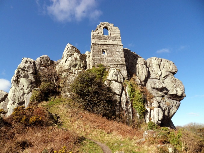
The association of Roche parish church with Roche Rock to the south has long been an important one and, until modern development obscured the way, there was a visible connection between the church and the ruined chapel on the rock. The history of Roche church goes back to Norman times with a font of that period and a cross in the churchyard of unusual proportions and decoration. The current church dates to the fifteenth century, albeit with an interior modified in the late nineteenth century, and its exceptionally tall tower looks across the tree tops to Roche Chapel, also built in the early fifteenth century and dedicated in 1409, as is common with chapels in high places, to St Michael.

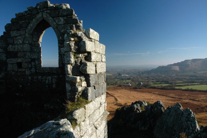
The chapel, built on the precipitous outcrop, ingeniously incorporates the bedrock in its structure. Built of large squared blocks of granite, probably quarried from the surrounding moor, its construction in this position must have been a masterpiece of mediæval engineering. It stands two storeys high with a lower room in which, according to tradition, lived a hermit attended by his daughter who fetched water for him from a hole in the rocks known as Gonetta’s Well. The room above served as the chapel. Although the west wall has all but disappeared, the east wall survives to almost its full original height, with a large arched window now missing its tracery. Old drawings of the rock hint at further buildings on top of the rock, but these have long disappeared, as has the chapel’s roof. Access to the chapel was originally by rock-cut steps but is now by an iron ladder.
The precise reason for building it is unclear. It may simply represent continuity of religious activity on a site long-venerated or may be a pious but very visible reminder of the importance of the person or group that funded its construction. One suggestion is that it could have stood as a light or beacon for guiding travellers across the moors; another that it was set up in imitation of the most famous place of pilgrimage of St Michael in Cornwall, St Michael’s Mount, perhaps even with the aim of attracting pilgrims en route for the Mount.
It is common to find high points and islands dedicated to St Michael the Archangel. St Michael's Mount, Chapel Carn Brea, Roche Rock, Looe Island (historically the island of St Michael of Lammana, NOT the renamed St George's Island!), Rough Tor, Brent Tor, and Glastonbury Tor to name but a few.
- Cornish
- English
- Log in to post comments


