Celtic Recipes

Porthtowan

Porthtowan is a coastal village on the Atlantic Coast about three miles north of Redruth. Historically mining was important to the village and the remains Wheal Coates mine are nearby. Tourism developed into an important factor following the decline of the mining industry. Porthtowan is known for surfing and a sandy beach with dunes.

Redruth - Resrudh

Redruth/Resrudh is a town to the north east of Camborne and about nine miles west of Truro and developed with the expansion of the mining industry. The church of St Uny was built in 1756 on an original Norman site. Murdoch House built in the seventeenth century originally as a chapel is next door to St Rumon's Gardens. The Cornish Studies Centre in Alma Place houses the Tregellas Tapestries as well as books, maps and other written material. It is also the location of the Tourist Information Centre. On the edge of the town is Carn Brea the Neolithic Tor Enclosure and later Iron Age settlement. Carn Brea Castle, close to the top of the hill was originally built as a chapel, in 1379 and then rebuilt as a hunting lodge in the eighteenth century. The town has market and shopping facilities as well as other leisure industry outlets.

Carn Brea

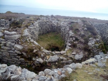
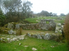
The Carn Brea hill has site encircling stone walls constructed about six thousand years ago. A series of large stone walls encircle the central and eastern tors of the hill, with a double set of ramparts built across the slopes which links both and encloses the area between them. Excavations in point to them dating to the Early Neolithic period of between 4,000 and 3,500 BC. Archaeological digs in the interior of the eastern enclosure uncovered remains of rectangular lean-to houses against the internal face of the ramparts. Flint arrow heads found around the main entrance to the enclosure indicated that the site had been attacked by warriors with evidence that the houses had been burned down, pointing to a period of tribal warfare.

Camborne

Camborne/Kambronn is a town north east of St Ives off the A30 that expanded during the mining boom in the eighteenth and nineteenth centuries. Camborne's parish church was built in the fifteenth century. Here is tenth or eleventh century alter stone set in the alter of the church which came from Chapel La. The churchyard is home to a number of crosses brought from other sites. The town has a number of light industries and has developed into popular place to visit with shopping and leisure facilities.

Illogan - Egloshal

Illogan/Egloshal village which is southeast of Portreath which is about two miles northwest of Redruth. The medieval church of St Illogan is located here of which the tower is now all that remains of the original building.

Portreath

Portreath is a fishing port on the B3301 north east from Gwithian three miles north west from Redruth. The village is centred around the harbour and to the west is the popular tourist and water sport beach.

St Just - Lannyust

St Just Church

St Just (Lannyust) is a town north of Ballowall Barrow and on the B3306 and is about eight miles west of Penzance. The settlement has a long mining history. The church of St Just was built in 1334 but only part of the chancel remains from that period with the current building dating from the fifteenth century. On the common green is Plain-an-Gwarry which has historically and continues to be used for entertainments.

Ballowall Barrow or Carn Gluze

Ballowall Barrow or Carn Gluze

Ballowall is a prehistoric cairn which incorporates other phases of use in the Neolithic and Middle Bronze Age periods. It is located on Ballowall Common on the cliff top south of St Just. The barrow is 72 feet in diameter and is a protected Scheduled Monument.

Boscawen-un Stone Circle

Boscawen Stone Circle is situated beneath the southern slopes of Creeg Tol. An enclosed circular bank built in the 19th century to replace an earlier boundary that bisected the circle. The oval shaped circle is made up of nineteen large upright stones. In the centre of the circle lies a tall stone with two axe carvings on it's north-east face. There are remains of later Bronze Age field systems in the area and of four Bronze Age barrows and a Neolithic/Bronze Age menhir to the north-east. The site is to the east of Crows-an-Wra and reached by a track that runs from the A30 towards Boscawenoon and Changwens farms which is a public right of way. There is also a path over open access land from the A30 to the north-west.

Carn Euny

Carn Euny

Carn Euny is the remains of a settlement dating from the Iron Age into the Romano-British period. There are several buildings consisting of a dry stone wall around an open courtyard with a dwelling house built into the wall opposite the entrance with lean-to structures along either side. Adjoining the one of the courtyard houses is a fogou. The site is east from Landsend north of the A30 at Crows-an-Wra. The site can be reached by road with lay-by car parking at Brane and then on foot via a public footpath.

Pages