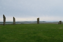
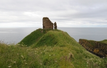
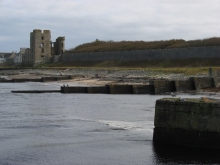
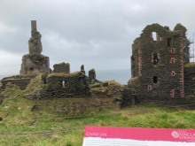
Kirkwall/Baile na-h-Eaglais
Kirkwall/Baile na-h-Eaglais is the capital of Orkney, located in the centre of Mainland and the port has ferry services to Aberdeen and Lerwick as well as the other main north islands in the archipelago. In the town is the Orkney Museum, Tankerness House, Broadstreet, Kirkwall. It is housed in a sixteenth century town house. The museum has an important collection and gives the history of Orkney from the Mesolithic, Neolithic and Pict times through to the Viking period until the present day. The museum is open throughout the year from Mon-Sat 10:30-17:00. Also in Kirkwall is St Magnus Cathedral which was built for the Norse Earls of Orkney. Construction of the Cathedral, which was part of the Norwegian church, began in 1137 and it has been added to over subsequent centuries. Next to the Cathedral are the ruins of the Bishop's Palace and Earl's Palace. The Bishop's Palace was built at the same time as the Cathedral and was home to the first Bishop William the Old (William Sennex). The Earl's Palace was constructed from 1607 by Patrick Stewart, 2nd Earl of Orkney. It's ruins lie close to the cathedral in the centre of Kirkwall.