Celtic Recipes

Bryn y Castell

Bryn y Castell, Ffestiniog © RCAHM 94-CS-0901

This is a small Iron Age hillfort site where archaeological evidence points to iron smelting having taken place. Some reconstruction has taken place on the site which gives an impression of how it looked. It is located east from Ffestiniog in Gwynedd in Wales, towards Bala on the B4391 and access to the site is on the north side of Bryn y Castell.

Castell-y-Bere

Castell y Bere. Image Cadw

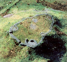
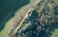
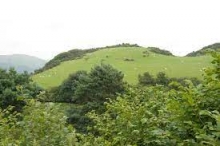
Castell-y-Bere. This Welsh castle was built by Llewellyn ap Iowerth in 1221 and gives commanding views over the Dysynni valley. It is situated on a rocky hill and has twin D shaped towers with the ruins of the chapel tower, stairs, walls and keep are also still visible. A year after Llewellyn ap Gruffydd's death the castle fell to Edward 1 in 1283 and was then burnt by Madog ap Llewellyn after which it was abandoned. The site is situated close to Llanfihangel-y-Pennant in the Meirionnydd area of Gwynedd in Wales.and is about two miles northwest of Aberglynolwyn, southwest of Dolgellau, off the B4405.

Castell Cynfael

Castell Cynfael

This is a Welsh castle in the motte and bailey style built in the twelfth century and has commanding views over the Dysynni valley. The castle mound is protected by a ditch and banking. The site is of the A493 going north from Aberdovey/Aberdyfi on the north side of the estuary of the River Dyfi and is about three miles northeast of Tywyn where footpaths from Byrncug take you to the castle.

Castell Gwallter

CASTELL GWALLTER

Castell Gwallter is located on a hill above the old village of Llandre (Welsh: Llanfihangel Genau'r Glyn) in northern Ceredigion, Wales, four miles northeast of Aberystwyth. It is an early twelfth century motte and bailey castle which seems to have been left to decay after the mid twelfth century. The mound and bailey can be seen and is protected by a ditch, although there does not appear to be any stone work remaining. The site is off the B4353 on private land (but can be viewed) about a mile west of Llandre, north of Aberystwyth.

Hen Gaer

Hen Gaer Marion Phillips / Ancient and Modern / CC BY-SA 2.0 © Copyright Marion Phillips and licensed for reuse under Creative Commons Licence.

Hen Gaer Iron Age hill fort is to the east of Bow Street, Ceredigion, Wales which is on the A487 north of Aberystwyth. It is on a site that gives commanding views. single rampart is about 12 metres (39 ft) wide and 3–4 metres (10–13 ft) above the interior, with a rock-cut external ditch.  On the north-east side stone blocks of the original rampart can be seen.

Trawscoed Fort

This is an Iron Age hill fort about eight miles southeast from Aberystwyth and close to the town of Trawscoed. Trawscoed is by the B4575 and on the River Ystwyth It dates from about 70 AD. The fort is about 207 feet above sea level and was surrounded by a ditch of nearly ten feet in width and about three feet deep.

Aberystwyth Castle - Castell Aberystwyth

Aberystwyth Castle ruins in the 1890s

Aberystwyth Castle - Castell Aberystwyth. The ruins of this thirteenth century castle are on a promontory at the south end of the promenade overlooking the harbour. It was captured by the Welsh in the late thirteenth century when still under construction, recaptured and then building completed. Owain Glyndŵr took the castle in 1406 and held it for two years. Aberystwith Castle also saw action in the Civil War until overrun by Parliamentary forces. The castle's layout is clearly seen today with ringwalls, corner towers and gatehouses. The site is situated overlooking the harbour at the south end of the Aberystwyth promenade and the seaside town is on the A487 and A44 in Ceredigion, Cymru.

Pen Dinas

Pen Dinas image from St Fagans National Museum of History

The hill of Pen Dinas and is the site of a Celtic Iron Age hill fort. Close by there is also a Bronze Age burial mound on the southern summit. There were originally two forts here that were then joined together making it an extensive site. The first of the forts to be built was on the northern lower summit and then a further one was built on higher ground to the south. The site is on the coast just south of the town of Aberystwyth above the village of Penparcau  in Ceredigion, Cymru.

Gaer Penrhos Hillfort - Llanrhystud Castle - Castell Cadwaladr

Caer Penrhos Llanrhystud map image courtesy of Ceredigion Historical Society

Gaer Penrhôs is the site of an Iron Age Fort that encircled a hill top above the junction of Afon Wyre Fawr and Afon Wyre Fach with commanding views. Within the hill fort are the outlines where the castle, built around the mid twelfth century, once stood. The site is off the B4337 close to and east of Llhanrhystud which is a coastal village on the A487 in Ceredigion, Cymru.

Trefilan Castle - Castell Trefilan

Castell Trefilan Ceredigion Historical Society and image courtesy of their webpage

Trefilan Castle - Castell Trefilan is located in Trefilan, Ceredigion, Cymru. It was built in the first half of the thirteenth century and little remains of this Welsh castle. The mound now still be seen and is located beside Trefilan parish church on the B4342.

Pages