Not quite the shake up we need in the Celtic nations!
There is no doubt that the Celtic nations would all benefit from the positive political shake-up offered by progressive nationalism. However, there are some shake-ups we could maybe do without. Seismic activity being one, with a recent study showing a number of areas in the Celtic nations being identified as some of the most earthquake prone in the British Isles.
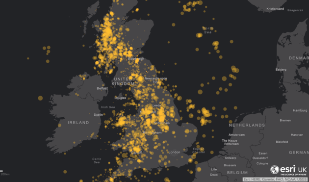
Using information collected from the British Geological Survey (BGS) to plot the location and size of every quake since 1970, mapping experts Esri UK marked data from over 10,000 earthquakes to create a graphic. In the top ten are the following that are within the Celtic nations: Edinburgh, Clackmannan, Knoydart Peninsula and Dumfries in Scotland. The Llyn Peninsula in Wales and Gweek in Cornwall.
The study was undertaken to celebrate National Richter Scale day held on 26th April. The Richter scale assigns a magnitude number to quantify the size of an earthquake. The scale was developed in 1935 by seismologists Charles Francis Richter and Beno Gutenberg of the California Institute of Technology. Gwynedd in north-west Wales, was the epicentre of one of Britain’s biggest earthquakes. Recorded in July 1984, the area was struck by a tremor measuring 5.4 on the Richter scale and was felt as far as Edinburgh.


